The Meatpacking District is one of the busiest pedestrian areas in New York City. But this infrastructure, designed to support industry, doesn't meet current needs of the people visiting the district—especially the section next to the West Side Highway known as the Western Gateway.
Our Western Gateway Public Realm Action Plan reimagines the streets in the area and repurposes them for people, creating pedestrian-first, community-driven spaces and connections to the waterfront.

A rendering of Gansevoort Plaza shows a lively public space with seating, greenery, and warm lighting.
Absent the attention and investment afforded other parts of the Meatpacking district, the Western Gateway's streets and public spaces remain an overlooked back-of-house that divides the district from the flourishing activity along the waterfront of the Hudson River.
To reach the piers and other destinations on the far west side, pedestrians must go through a confusing, uninviting corridor of wide streets, conflicting vehicle movements, and poor urban design.
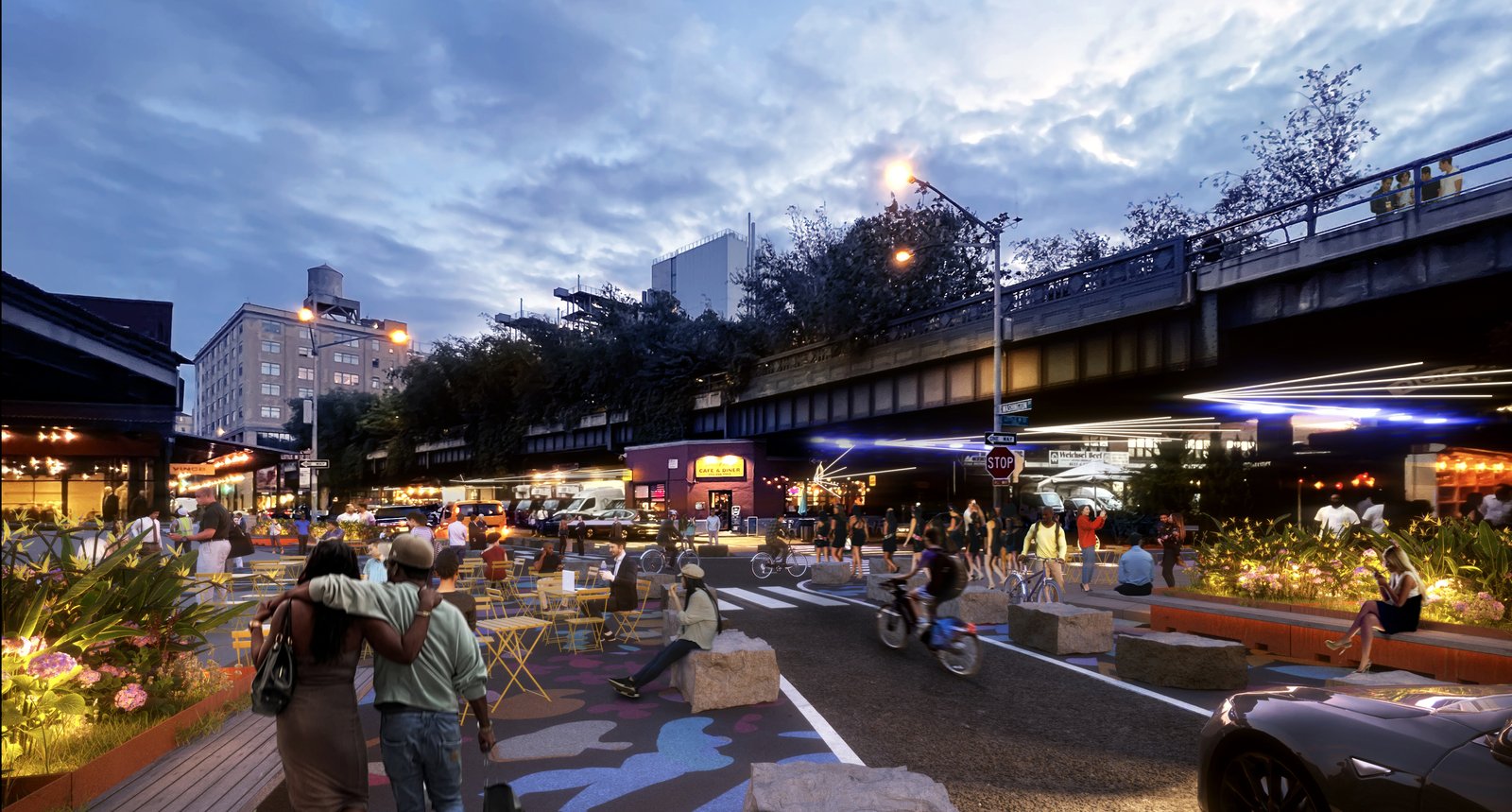
A rendering of Washington Street with outdoor seating, greenery, and evening lighting.
By layering onto the Meatpacking District's rich industrial, commercial, and cultural history, our Western Gateway Public Realm Action Plan creates a more connected and coordinated area. It links the shopping and pedestrian areas further east with attractions, including High Line Park, the Whitney Museum, Little Island, and Hudson River Park (which holds the southern end of the Hudson River Greenway).
The design accomplishes this by repurposing the streets with expanded sidewalks, new green space, public art, and expanded bicycle facilities. It prioritizes uses by time of day, putting people first during peak business hours with 21st-century freight management. It facilitates connectivity by forming new links across major roads, introducing public space nodes, and filling gaps in the bike network. The plan also reduces traffic by prioritizing safe spaces for people over vehicular throughput.
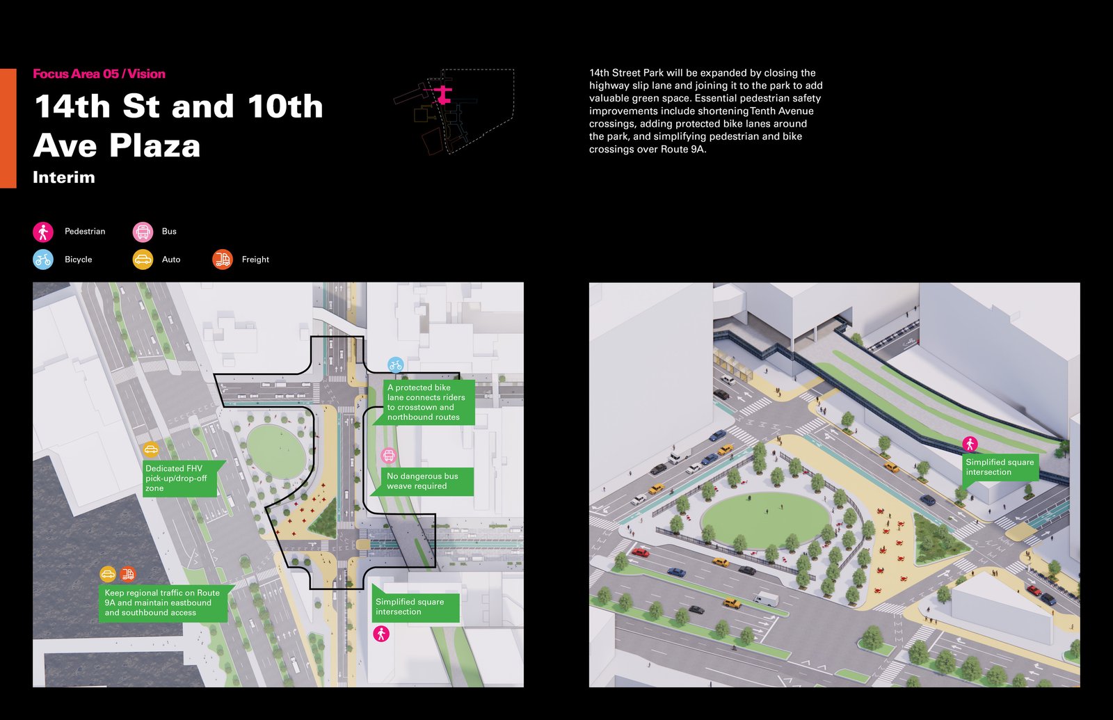
A diagram showing plans for 14th Street and 10th Avenue Plaza, featuring green space and safer bike lanes.
We conducted two months of business and community outreach to assess the operational and logistical needs of companies in the Western Gateway. The process included a listening tour with 18 key business and community stakeholders and a small business survey. We listened and incorporated the comments, opinions, and ideas into the plan.
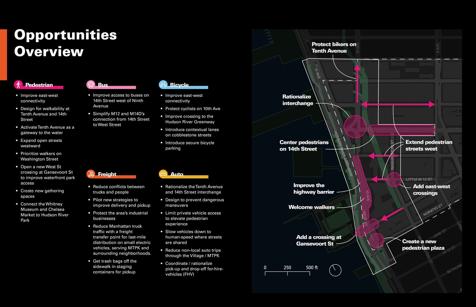
The diagram shows improved connectivity, safer bike routes, and enhanced public spaces.
With 113 businesses, 174,000 square feet of public plazas and parks, over 36,000 area employees, more than 40 bars and restaurants, and 58,000 daily visits, the Western Gateway Public Realm Action Plan is set to have an outsize impact on commerce, leisure, and community engagement in the area.
“The Meatpacking District has long defined trends in New York City. We hope that this project and multi-partner collaboration demonstrates what’s possible and in store for the future of pedestrian and community-oriented urban planning across the city.
”— Jeffrey LeFrancois, executive director, Meatpacking District Management Associate
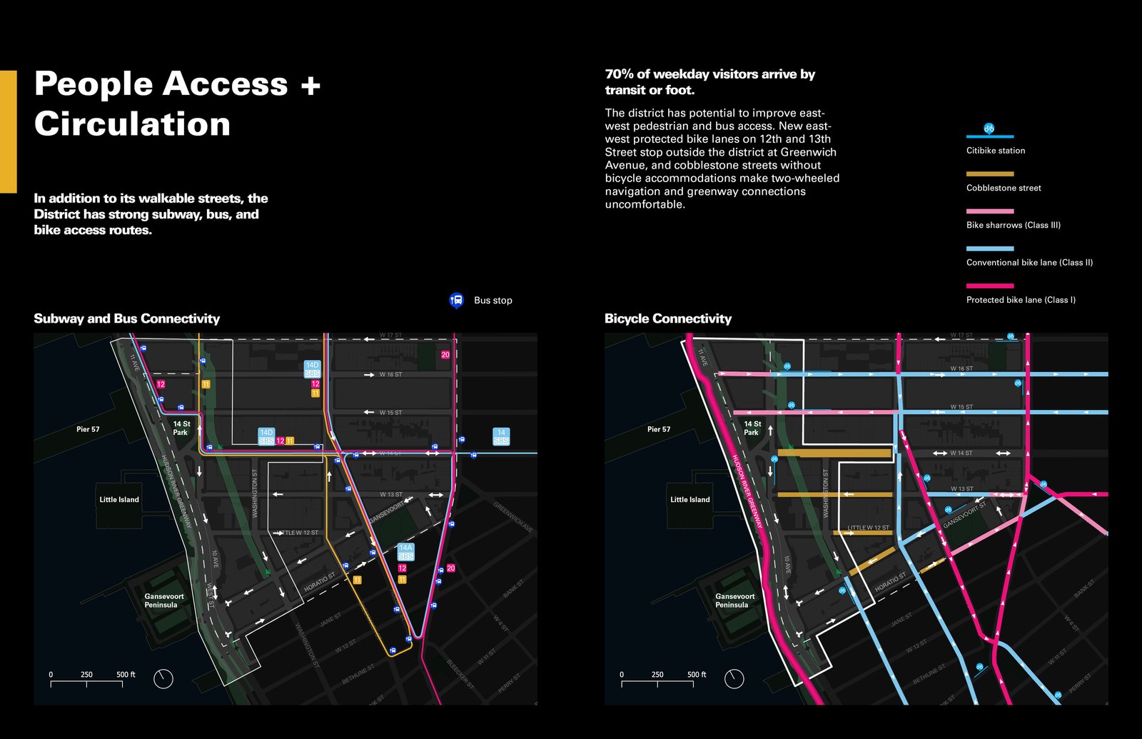
The diagram highlights transit and bike access in the walkable Western Gateway district.

A rendering of a revitalized intersection in the Meatpacking District with pedestrian-friendly design and vibrant public space.
Keywords
- Recreation
- Mobility
Type
- Public Realm Frameworks
- Strategic Plans
Client
- Meatpacking District Management Association
Collaborators
- Sam Schwartz Engineering
Team
- David Vega-Barachowitz
- Claire Weisz
- Annie Peyton
