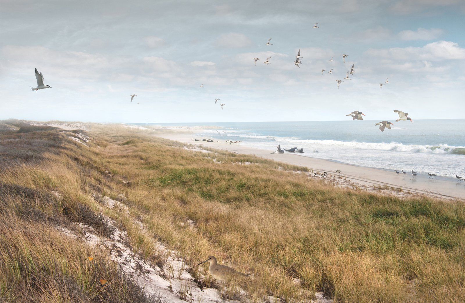
Restored coastal dunes merge ecology and resilience, safeguarding communities and habitats.
Shaped by scientific modeling and public dialogue, the plan’s offshore islands protect communities while expanding opportunities for biodiversity, recreation, and clean energy.
Blue Dunes envisions a network of offshore barrier islands as a transformative response to coastal resilience in the Northeast. Developed by WXY in partnership with WEST8 and a diverse team of experts, the project blends cutting-edge hydrodynamic modeling with a large-scale vision for regional storm surge protection. These dunes also offer potential thriving ecosystems that could safeguard communities while enriching regional biodiversity. Funded through the US government’s Rebuild by Design competition, this bold initiative highlights innovation at the intersection of design and science.
Superstorm Sandy exposed the vulnerabilities of the New York and New Jersey coastline. Coordinating a regional-scale solution proved difficult because the thousands of miles of coastline span with varied jurisdictions and priorities. The team needed to create an effective, scalable approach that could win support across municipalities and help reduce risks from extreme weather.

Manhattan’s skyline fades into darkness as a result of the power outage due to Superstorm Sandy.
The vision for the Blue Dunes project combines a natural barrier against storm surges with offshore wind energy infrastructure. These islands, designed through rigorous hydrodynamic and economic modeling, would mitigate flood risks while capitalizing on wind energy. They are envisioned as biodiverse habitats, enhancing the region’s ecological health while providing spaces for education and recreation. The design balances science and sustainability with a focus on measurable impact.
WXY brought together an unprecedented range of voices, from marine biologists and urban planners to catastrophic bond analysts and surfers. Through colloquia and public discussions, the team ensured that the project reflected multidisciplinary insights and community input. Materials and studies were presented to government agencies and residents alike, helping to bridge the gaps between expert knowledge and public needs and creating a model for bringing technical expertise and civic dialogue together.
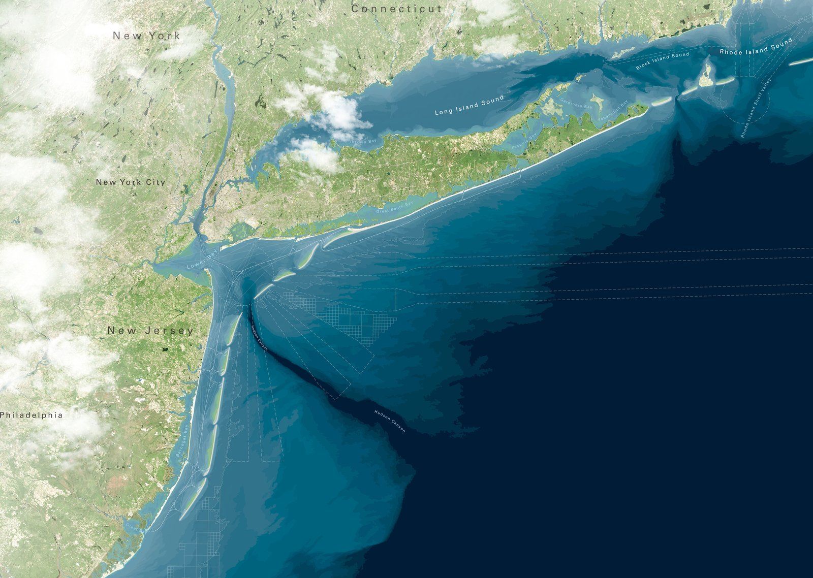
Proposed offshore islands provide a regional-scale solution for coastal resilience.
Blue Dunes offers a compelling case for regional resilience, with the potential to save millions annually in flood insurance costs and protect communities. The concept reimagines infrastructure as a living system, blending protection with environmental stewardship.
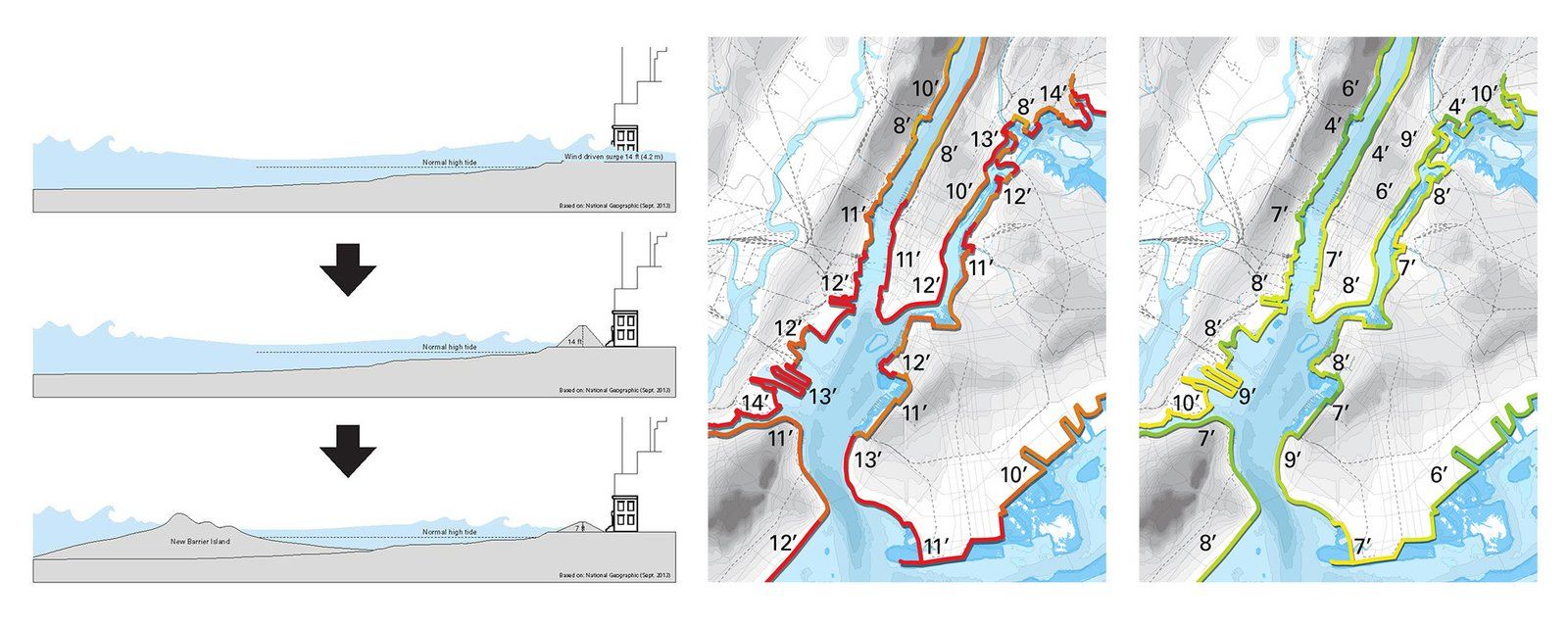
Proposed coastal barriers and flood maps illustrate strategies to mitigate storm surge risks.
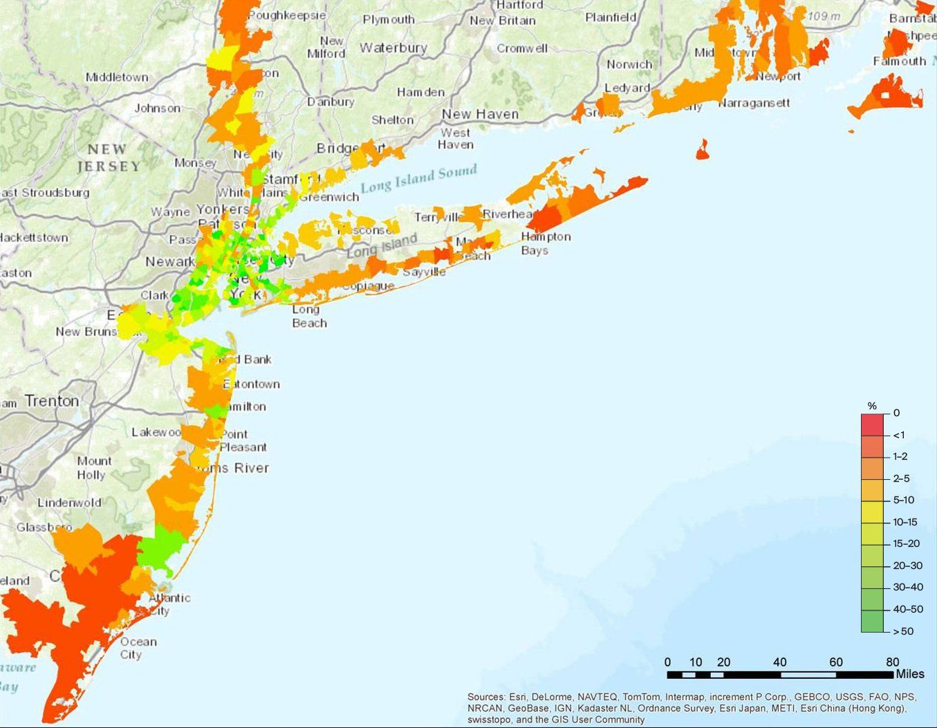
A regional vulnerability map highlights areas of high risk.
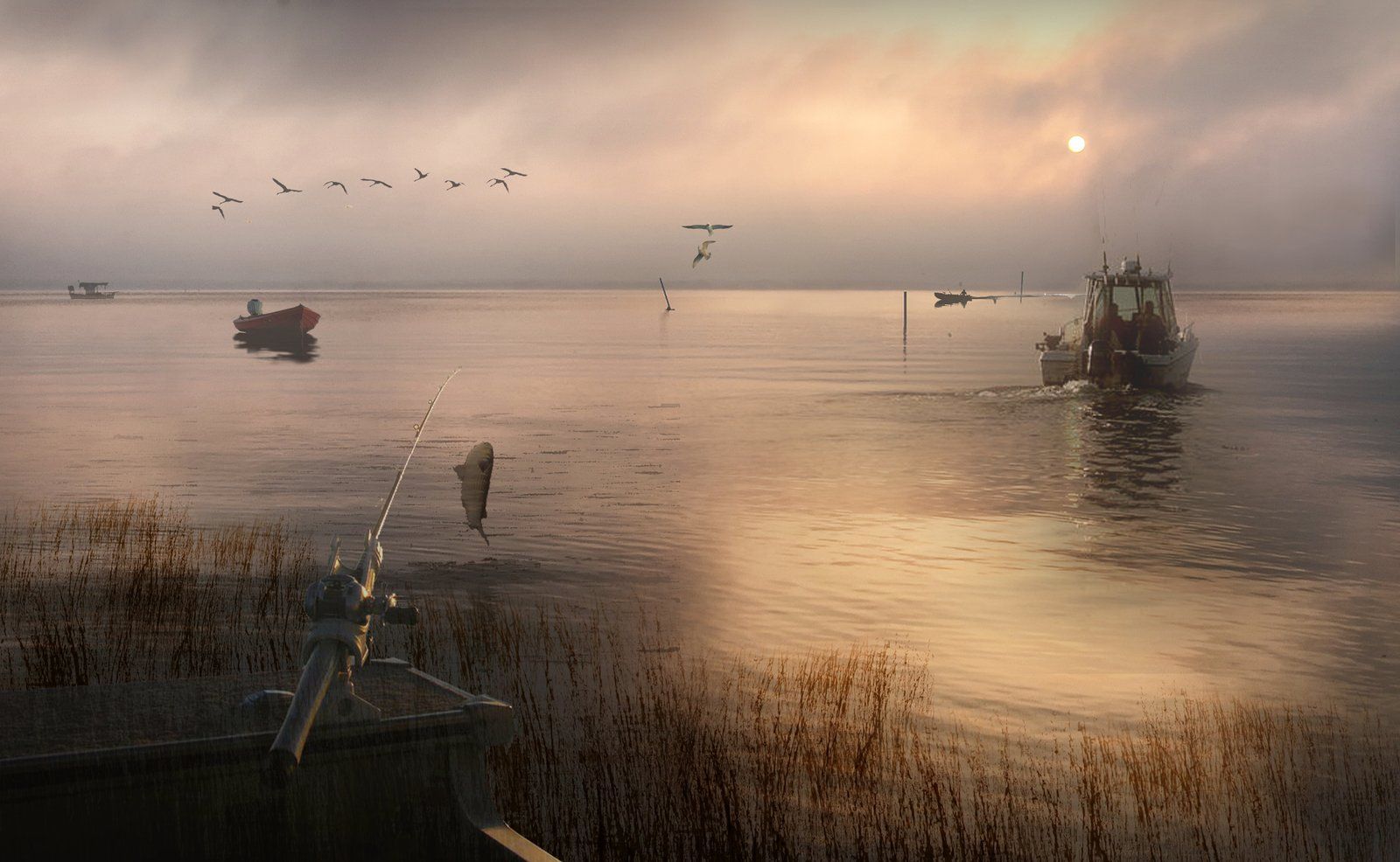
A rendering of Barnegat Bay shows sustainable fishing practices amid coastal scenery.
Claire Weisz Architects LLP
d/b/a WXY architecture + urban design
212 219 1953
office@wxystudio.com
Careers ↗
New York
25 Park Place, 5th Floor
New York, NY 10007
Toronto
30 St. Patrick Street, 5th Floor
Toronto, ON M5T 3A3 Canada
Subscribe to our newsletter
Site designed by Clinton Van Arnam
Developed by Mario Giampieri